Pages

March 27, 2016

Irish River No.2 (Hardscrabble)


There are two covered bridges in St. Martins, the only place in the province that still has bridges so close to one another.  They cross the Irish River as is empties into the harbor on the Bay of Fundy, and they are sometimes put in peril during storms when there are very high tides.  It looks like they will need to be raised soon, or become almost certain victims to the higher water levels associated with climate change.  I've added a photograph below that I took from the Village of St. Martins Facebook page from October 29th, 2015.  I don't know who to credit it to - sorry.


***
March 27th, 2016 - 

Our first ever 'off-season' visit to St. Martins, on Easter Sunday.  It was a gorgeous day and there were lots of other people out for a drive as well.  I noticed that there is a dam-like structure just upstream from this bridge, but can't find anything about it on any related websites.  I assume it is for flood control, or to block large ice chunks or trees from coming down and wrecking the bridge?  


March 11, 2016

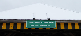
Turtle Creek No.4 (Peter Jonah)


Turtle Creek No.4 (Peter Jonah)

When a new dam and reservoir for the Greater Moncton water supply was built on Tower Road, the remaining Turtle Creek bridge was 'retired' and moved from its home in 2013, transported to a picturesque spot beside the pre-existing dam and reservoir.  They have done a nice job with it and it is clearly visible as you drive along Turtle Creek Road now.  The Peter Jonah bridge is notable for being one of the two remaining bridges in the province with the so called hip, or cottage, roof (the other one being Nelson Hollow).

Since I was just beginning to plan this blog project about the same time as this was going on, I took a couple of photographs of the bridge in its transition stage, though I did not get a chance to visit it before it was relocated.    I will add a couple of pictures from the Provincial Archives collection showing it at its original site first, then the consequent images from the first and second years after the move.

 Used with permission © Provincial Archives of NB


Used with permission © Provincial Archives of NB


***
March 11th, 2016 - A journey into Albert County to get some more winter bridge photographs.  Alas, a couple of minutes after I got there, a horde of people arrived to visit the sugar camp owned by the City of Moncton, which is right beside the bridge, and picnic tables had been set up inside it for people to shelter in.  So I couldn't get any more pictures that day but, it is certainly nice to see the bridge being used by the public. 


William Mitton Bridge


This is another 'retired' bridge, and also another one that is in need of some TLC, as the siding is falling apart in places.  

Different sources give this bridge the sobriquet  "travelling bridge", as it was originally located in Kent County somewhere.  In the Gillis book (No Faster Than A Walk, see "Sources" page), the bridge is reported to have travelled to its new site independently in the spring flooding. Well, I have studied the maps, and I cannot see any possible way this bridge could have made its way from Kent County, unimpeded, via any known watercourse, so I will have to look into this.  There would had to have been biblical-scale flooding in order to float all the way from Kent County to Upper Coverdale - or was it swept out to sea and then came back up the Petitcodiac with the tidal bore!   Whatever it turns out to be, there will be a good story that goes with it in order for the tale to end with the bridge just showing up here in the spring thaw.


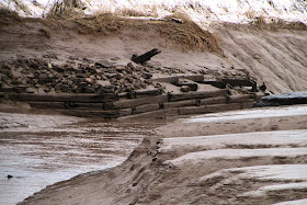
In the Archive photo below, you can see the old Coverdale bridge in the background.  The remains of the abutment can still clearly be seen on the bank of the river in 2015.


Used with permission © Provincial Archives of NB

Used with permission © Provincial Archives of NB


***
March 11, 2016 - A visit with the tide most of the way out.  You can get an idea from these pictures of how the enormous Bay of Fundy tides affect things far upstream in the Petitcodiac River.